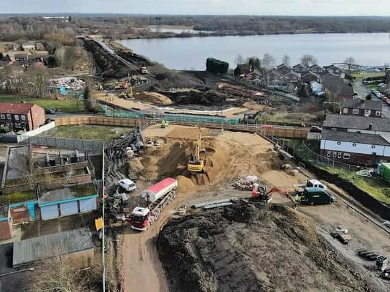
A bird’s-eye view of how Wigan's major new link road is developing


Reader Brian King’s drone took to the skies to capture this telling snapshot of how the route south of the town centre aims to relieve pressures on its groaning infrastructure.
For those struggling to get their bearings: Wigan town centre is to the left, Marus Bridge to the right and Poolstock Lane is halfway up the picture.
Advertisement
Hide AdAdvertisement
Hide AdBeyond that the A49 link road can be seen heading across the northern side of Scotman’s Flash after which it will join Westwood Way, connecting to Poolstock and Chapel Lane.
Behind the camera the road heads on up to the A49 Warrington Road at Goose Green. Under further phases the plan is to take the road up through
Pemberton where it will hook up with the M6/M58 junction while in the other direction it will snake its way to the M61 at Westhoughton.
Two bridges need to be built for this section pictured. One passes over Poolstock Lane and the other will straddle the canal (see below left).
Advertisement
Hide AdAdvertisement
Hide AdThe link road has been on Wigan’s wish list for decades. Originally called Route 225, it has been on the brink of being built on several occasions only for the plans to be cancelled.
The Westwood-Goose Green section is expected to be completed by the middle of next year.