Revealed: the roads where Wigan Council plans to spend £5.3m on repairs
and live on Freeview channel 276
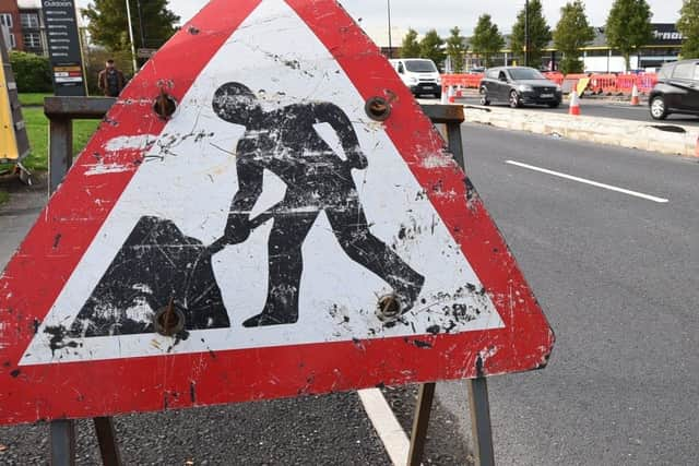
The wet winter months have played havoc on the borough’s roads, with drivers complaining of crumbling carriageways and trying to dodge potholes.
An investigation into road repairs in the UK was launched by Accident Claims Advice following an influx of inquiries relating to damages caused by potholes and poorly maintained roads.
Advertisement
Hide AdAdvertisement
Hide AdData obtained from Freedom of Information requests reveals Wigan Council has a list of roads set be resurfaced, as well as footpaths and carriageway maintenance work planned across the borough.

Over the new financial year, which started on April 1, it has confirmed a budget of £5.3m for repairs. A total of £1,077,480 has been allocated for pothole repairs.
Some, however, are not the local authority’s responsibility.
A spokesperson for Wigan Council said: “Our roads are ranked as some of the best both regionally and nationally as a result of our planned maintenance program where we invest around £5m a year.
Advertisement
Hide AdAdvertisement
Hide Ad"By prioritising the available funding into planned surfacing and preventative maintenance, we are able to prevent and reduce the number of defects on our highways.”
A spokesman for Accident Claims Advice, which deals with accident compensation and personal injury claims, said: “Local authorities or councils are usually responsible for the maintenance and repair of public highways and pavements under the Highways Act.
“This requires them to inspect highways regularly and repair them in an efficient manner when defects such as potholes are identified.
“Therefore, if you are injured by a pothole on a public highway that was known about but not rectified quickly, you could sue the council/local authority for your injuries.”
Advertisement
Hide AdAdvertisement
Hide AdWith UK councils facing a potential major financial crisis, with a £4bn funding gap estimated in the next two years, some authorities have forked out huge amounts in road maintenance repairs.
Accident Claims Advice has collated a list of every road Wigan Council is set to work on.
In addition, the council plans a number of repairs on carriageway and footways, including footway preventive maintenance.
Carriageway Resurfacing Works (Key Route Network)
- A49 Wigan Lane (Springfield Street - Penson Street) Wigan
- A49 Powell Street (A49 River Way Junction) Wigan
- A49 Wigan Road (B5207 Bryn Road Junction) Bryn
- A49 Wigan Road (Alexandra Road - Bryn Street) Ashton
- A58 Liverpool Road (St Helens Boundary - Satinwood Close) Ashton
- A58 Liverpool Road (A49 Warrington Road Junction) Ashton
- A58 Bolton Road (Wigan Road - O/S No.101d) Ashton
- A58 Bridge Street (Market Street - Castle Hill Road) Hindley
- A572 Newton Road/St Helens Road (Sandy Lane - O/S No.476) Lowton
- A577 Ormskirk Road (Richmond Hill - Smethurst Road) Pemberton
- A577 Ormskirk Road (O/S No.526 - Ellesmere Road) Wigan
- A577 Atherton Road (Lord Street - O/S No.118) Hindley
- A577 Atherton Road (Harlea Avenue - Long Lane) Hindley Green
- A577 Manchester Road including (O/S No.176 - O/S No.295) Tyldesley
- A577 Manchester Road (O/S No.295 - Hough Lane) Tyldesley
- A578 Wigan Road (O/S No.236 - O/S No.296) Leigh
- A579 Bolton Road (Mealhouse Lane - O/S No.38) Atherton
- A580 Atherleigh Way (Lovers Lane - Lighting Column No.160) Atherton/Leigh
- A5209 Almond Brook Road (Beacon View - O/S No.164) Standish
Carriageway Resurfacing Works (Non-Key Route Network)
- A571 Billinge Road (Tunstall Lane - St Matthews Close) Pemberton
- A5106 Chorley Road (Wigan Road - Water Drive) Standish
- B5206 Gathurst Lane/Broad O'th Lane/Shevington Lane (O/S No.1 - O/S No.20) Shevington
- B5207 Bryn Road (Lockett Road - New Street) Ashton
- B5238 Whelley (Great Acre - Plantation Gates) Whelley
- B5375 Church Lane (Full Length) Shevington
- Back Lane (Crow Orchard Road - Pumping Station) Appley Bridge
- Firs Lane (Cunliffe Street - Charity Street) Leigh
- Frog Lane (Proe's Court - Lower St Stephens Street) Wigan
- Greenough Street (Full Length) Wigan
- Pepper Lane (Preston Road - Almond Green Avenue) Standish
- Scholefield Lane (Opp. Baldwin Street - Gilroy Street) Scholes
- Wallgate (Queen Street - O/S Wigan NW Station) Wigan
- Swinley Road (Kenyon Road - O/S No.92) Wigan
- Swan Lane (Atherton Road - O/S No.103/105) Hindley Green
- All Saints Grove (Full Length) Hindley
- Ascroft Avenue (Rose Avenue - Cherry Grove) Beech Hill
- Beech Hill Avenue / Scot Lane (Woodhouse Drive Junction) Beech Hill
- Beverley Avenue (Full Length) Billinge
- Chestnut Drive (Beechfield Drive - Landside) Leigh
- Coach House Drive (Full Length) Shevington
- Crank Road including (Up Holland Road - Brownlow Lane) Billinge
- Upholland Road (Bus Stop - Zebra Crossing) Billinge
- Dodhurst Road including (Full Length) Hindley
- Sandy Lane (O/S No.116/118) Hindley
- Dunster Place (Full Length) Tyldesley
- Garton Drive (Durrell Way - Lane Head Avenue) Lowton
- Green Lane (Full Length) Standish
- Hand Lane (Clifton Road - Beech Walk) Leigh
- Heath Gardens (Full Length) Hindley Green
- Lindale Road (Full Length) Tyldesley
- Longridge Avenue (Grove Lane - Grove Place) Standish
- Mill Lane including (Tyldesley Road - Lodge Road) Tyldesley
- Powys Street (Lodge Road - O/S No.9) Tyldesley
- Montrose Avenue (Greenwood Avenue - Matheson Drive) Wigan
- Norley Road (City Road - Cul-De-Sac End) Wigan
- Pennygate Close (Full Length) Hindley
- Sankey Street including (Full Length) Golborne
- Talbot Street including (Full Length) Golborne
- Peter Street (Talbot Street - O/S No.8) Golborne
- Sittingbourne Road (Full Length) Wigan
- Spa Road (Everest Road - Hatton Avenue) Atherton
- Stadium Way (Scot Lane - Adoption Limit) Wigan
- St Pauls Avenue (Poolstock Lane - Walpole Avenue) Marus Bridge
- Thomas Street (Organ Street - Leigh Road) Hindley Green
- Tunstall Lane (Valley Road - Billinge Road) Wigan
- York Avenue / Lancaster Avenue (Warwick Road - Cumberland Avenue) Tyldesley
- Wellfield Road including (Rose Avenue - Cul-De-Sac End) Beech Hill
- Yew Grove (Full Length) Beech Hill
- Great Acre including (O/S No.53 - Kelway Terrace) Whelley
- Kelway Terrace including (Full Length) Whelley
- West Mount (Full Length) Whelley
- Wareing Street (Elliot Street - O/S No.20) Tyldesley
- Co-operative Street including (Full Length) Leigh
- Cowper Street (Urmston Street - Co-operative Street) Leigh
- Bradshawgate (Brown Street South - Vernon Street) Leigh
- Willow Crescent (Full Length) Leigh
- Broomfield Road (Full Length) Standish
- Parkbrook Lane (Full Length) Shevington
- Tan House Drive including (Burley Crescent - Sykes Crescent) Winstanley
- Homes House Avenue (LC No.40 - Crowther Drive R/B) Winstanley
You can report any potholes or road issues at https://www.wigan.gov.uk/Report-it/Report-a-problem.aspx
Comment Guidelines
National World encourages reader discussion on our stories. User feedback, insights and back-and-forth exchanges add a rich layer of context to reporting. Please review our Community Guidelines before commenting.