
UK weather: When UKHSA cold health alert will come into force in Wigan
Watch the Met Office forecast, as a cold health alert is issued for north west England.
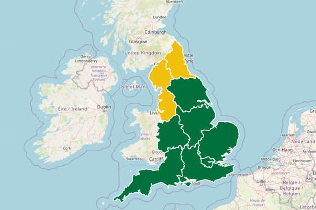
The UK Health Security Agency (UKHSA) has issued a cold health alert for north west England.
The alert will come into force on Monday January 26 at 18:00 and is scheduled to end at 18:00 on January 30 2026.
The alert, which has a risk score of 7 - with a low impact and medium likelihood, reads: “Forecast weather is likely to have minor impacts on health and social care services, including: increased use of healthcare services by vulnerable people and a greater risk to life of vulnerable people.”

Met Office north west England weather forecast
Monday (January 26)
Largely cloudy and chilly with the odd glimmer of brightness possible in the west. winds picking up during the afternoon with a chance of some rain later in the evening. Maximum temperature 5 °C.
Outlook for Tuesday (January 27) to Thursday (January 29)
Often wet and windy with gales possible at times. Hill snow likely on Tuesday, with a chance of substantial falls over the Pennines highest ground. Further showers on Wednesday thereafter.
Met Office UK long-range forecast
Friday January 30 to Sunday February 8
Weather systems from the Atlantic will continue to attempt to push in from the west, but tending to stall in the vicinity of the UK as they encounter high pressure to the north and northeast. As a result, further spells of rain or showers as well as strong winds are expected at times. Rain may be heavy and persistent, especially in the south and west. Whilst mild conditions are expected to encroach into the south and southwest at times, cold air is likely to be positioned to the northeast, bringing wintry showers at times. Where fronts from the southwest do reach the cold air towards the northeast, there is the risk of some snow, most likely across hills, but perhaps extending to lower areas at times.
Monday February 9 to Monday February 23
A similar theme from early February is most likely to continue as Atlantic frontal systems attempt to move across the country. With the jet stream likely further south than normal, the wettest conditions are more likely in central and southern areas. North and northwestern parts of the UK are most likely to be drier than normal. Whilst mild incursions of wet and windy weather are favoured at times in the south and west, colder conditions in the north and northeast will bring an increased risk of wintry hazards, especially where any precipitation from the southwest interacts with the cold air.