
Storm Floris: Met Office wind warning issued for Wigan as forecaster names first storm since January

Watch the latest Met Office video forecast, with meteorologist Alex Burkill explaining how Storm Floris’ summer timing could bring increased disruption.
A Met Office wind warning has been issued for Wigan as Storm Floris is to hit the country.
The yellow wind warning will be in place for Wigan from 06:00 on August 4 to 06:00 on August 5.
Met Office yellow wind warning
The warning reads: “Storm Floris is likely to bring a spell of unseasonably strong and potentially disruptive winds to northern UK on Monday into early Tuesday.
“Some damage to buildings, such as tiles blown from roofs, could happen. Injuries and danger to life from flying debris are possible. Power cuts may occur, with the potential to affect other services, such as mobile phone coverage. Injuries and danger to life could occur from large waves and beach material being thrown onto sea fronts, coastal roads and properties. Some roads and bridges may close. Road, rail, air and ferry services may be affected, with longer journey times and cancellations possible.
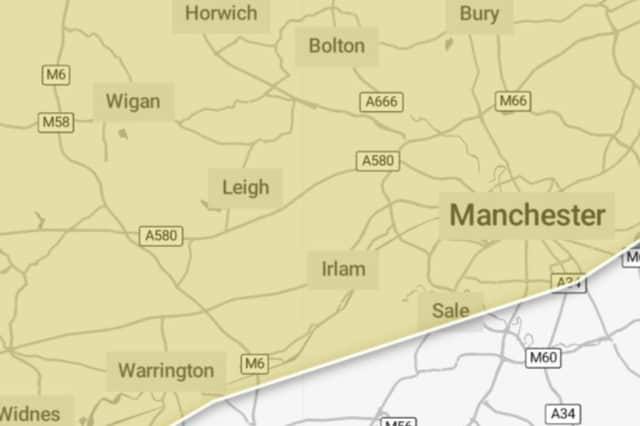
“Storm Floris will bring a spell of unusually windy weather for the time of year across the northern half of the UK early next week. The strongest winds are most likely to occur across Scotland during Monday afternoon and night, although there remains some uncertainty in the depth and track of Floris. Across the warning area, many inland areas are likely to see westerly wind gusts of 40-50 mph with 60-70 mph possible along exposed coasts and high ground, especially Scotland. There is a chance of a spell of even stronger winds developing for a time, with inland gusts of 60-70 mph and 85 mph along exposed Scottish coastlines and hills. Winds will first ease in the west during later Monday but remaining very strong overnight until early Tuesday in the east. Heavy rain may also contribute to the disruption in places.”
Storm Floris is named by Met Office
Storm Floris has been named by the Met Office, with disruptive winds likely for northern UK from August 4.
Storm Floris is the sixth named storm of the 2024/2025 storm naming season.
The last named storm to affect the UK was Storm Éowyn, which occurred in late January.
Alex Burkill, Met Office presenter and meteorologist, said: “It’s not that often that we get storms during the summer months, but it’s worth bearing in mind that at this time of year we could see some increased disruption because of the fact the trees are full of leaves and there are lots of outdoor activities planned.”